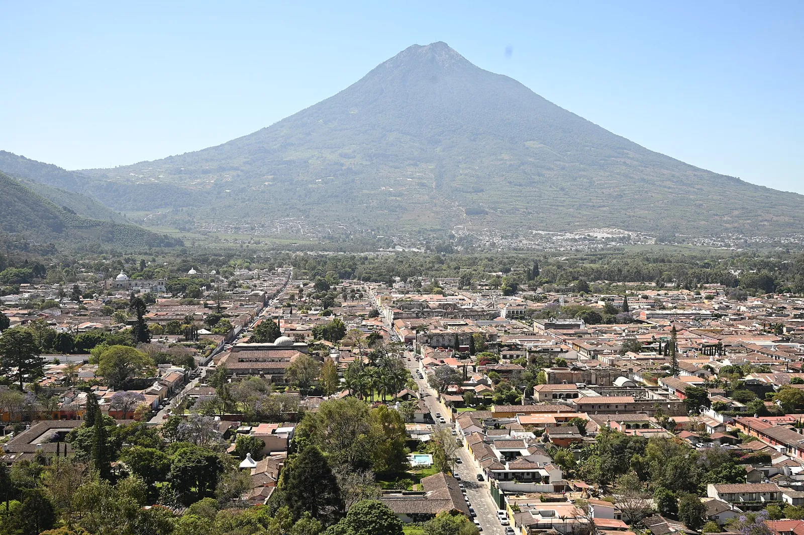
Earthquakes in Guatemala: Motagua Fault and Pacific Coast Today

The Motagua Fault crosses Guatemala from the Caribbean to the highlands, marking the North American–Caribbean plate boundary that ruptured in 1976. Along the Pacific coast, subduction of the Cocos plate adds frequent offshore earthquakes and a chain of active volcanoes.

Danger Level (72h)

72-hour composite hazard forecast

61%

Recent Quakes (14d)

Recorded in the selected 14d period

81

Max Magnitude (14d)

Largest earthquake in the selected 14d period

M5.6

Tectonic Profile

Seismotectonic hazard assessment, structural exposure & historical context

Associated Faults3

Click to locate on map

Regional PopulationLandScan

18.3M

Living within seismically active radius (~300 km)

Building VulnerabilityHigh

High

Unreinforced masonry or non-ductile structures vulnerable to shaking

Tectonic Setting

Subduction Zone

High Hazard

Active fault boundary with frequent seismicity

MAG5.6
Most Significant Earthquake (14d)PAGER green

Off the coast of Escuintla (85 km S, Guatemala)

4d ago· Depth 35 km
Exposed Population (MMI6+)0
Estimated Fatalities0
Filter:
•
Sort by:
••
3.2

87 km SE of Managua (Nicaragua)

EMSC
151 km•4h ago
3.1

Off the coast of Sonsonate (108 km SW, El Salvador)

EMSC
21 km•12h ago
3.5

Off the coast of Escuintla (95 km S, Guatemala)

EMSC
30 km•13h ago
3.0

Caribbean Sea (55 km SW of Chinandega, Nicaragua)

EMSC
35 km•14h ago
3.6

85 km N of Salina Cruz (Mexico)

SSN 3.6+1
104 km•16h ago
3.2

44 km W of Escuintla (Mexico)

SSN 3.2+1
106 km•16h ago
3.6

65 km SW of Tuxtla Gutiérrez (Mexico)

SSN 3.6+1
16.5 km•16h ago
3.3

Off the coast of Salina Cruz (58 km S, Mexico)

SSN 3.3+1
16.4 km•16h ago
4.0

Off the coast of Tapachula (72 km SW, Mexico)

SSN 4.0+1
11.2 km•20h ago
4.0

69 km N of Liberia (Costa Rica)

EMSC
165 km•22h ago
3.6

Off the coast of Tuxtla Gutiérrez (145 km SW, Mexico)

SSN 3.6+1
88.6 km•1d ago
3.9

Off the coast of Tapachula (84 km SW, Mexico)

SSN 3.9+1
10.1 km•1d ago
3.8

Off the coast of Salina Cruz (175 km SE, Mexico)

SSN 3.8+1
10 km•1d ago
3.5

110 km W of Tuxtla Gutiérrez (Mexico)

SSN 3.5+1
137.9 km•1d ago
3.6

Near Zacapa (Guatemala)

EMSC
6 km•1d ago
3.6

Off the coast of Sonsonate (70 km SW, El Salvador)

EMSC
20 km•1d ago
4.6

Off the coast of San Salvador (61 km SW, El Salvador)

USGS 4.6+1
59.1 km•1d ago
3.7

Off the coast of Tuxtla Gutiérrez (197 km S, Mexico)

SSN 3.7+1
28.6 km•1d ago
3.6

77 km W of Tuxtla Gutiérrez (Mexico)

SSN 3.6+1
131.2 km•1d ago
3.6

Caribbean Sea (43 km S of Managua, Nicaragua)

EMSC
209 km•1d ago
3.5

Off the coast of Escuintla (47 km SW, Mexico)

SSN 3.5+1
89.1 km•1d ago
4.4

17 km SE of Chinandega (Nicaragua)

EMSC
138 km•1d ago
3.5

Off the coast of Escuintla (34 km SW, Mexico)

SSN 3.5+1
102.3 km•2d ago
3.7

Off the coast of Salina Cruz (125 km SE, Mexico)

SSN 3.7+1
16.2 km•2d ago
3.3

110 km W of Tuxtla Gutiérrez (Mexico)

SSN 3.3+1
120 km•2d ago
3.6

75 km W of Escuintla (Mexico)

SSN 3.6+1
97.7 km•2d ago
3.7

Off the coast of Tapachula (113 km SW, Mexico)

SSN 3.7+1
16.1 km•2d ago
3.0

36 km S of Guatemala City (Guatemala)

EMSC
198 km•2d ago
3.6

37 km W of Escuintla (Mexico)

SSN 3.6+1
111.4 km•2d ago
4.1

Off the coast of Tapachula (143 km SW, Mexico)

SSN 4.1+1
10.2 km•2d ago
4.0

80 km S of Juticalpa (Honduras)

EMSC
15 km•2d ago
3.3

61 km SW of Minatitlán (Mexico)

SSN 3.3+1
126.7 km•2d ago
3.1

Off the coast of Sonsonate (113 km SW, El Salvador)

EMSC
3 km•2d ago
3.7

Off the coast of Tuxtla Gutiérrez (144 km SW, Mexico)

SSN 3.7+1
78.1 km•2d ago
3.6

108 km NE of Salina Cruz (Mexico)

SSN 3.6+1
111.9 km•2d ago
3.4

Off the coast of Salina Cruz (74 km SE, Mexico)

SSN 3.4+1
16.1 km•2d ago
3.4

Off the coast of Tuxtla Gutiérrez (142 km SW, Mexico)

SSN 3.4+1
78.6 km•2d ago
4.0

Off the coast of Tuxtla Gutiérrez (139 km SW, Mexico)

SSN 4.0+1
73.1 km•2d ago
3.8

Off the coast of León (235 km SW, Nicaragua)

EMSC
200 km•2d ago
4.2

Off the coast of Quetzaltenango (195 km SW, Guatemala)

SSN 4.2+1
10 km•2d ago
3.2

Near Zacapa (Guatemala)

EMSC
2 km•2d ago•👥 391k
4.0

Off the coast of Salina Cruz (70 km S, Mexico)

SSN 4.0+1
16.2 km•2d ago
3.6

87 km NE of Salina Cruz (Mexico)

SSN 3.6+1
120.5 km•3d ago
3.8

Off the coast of Salina Cruz (105 km E, Mexico)

SSN 3.8+1
80.3 km•3d ago
3.8

Off the coast of Ahuachapán (54 km SW, El Salvador)

EMSC
77.4 km•3d ago
3.2

Off the coast of Escuintla (81 km SW, Guatemala)

EMSC
12 km•3d ago
3.5

Off the coast of Salina Cruz (104 km SE, Mexico)

SSN 3.5+1
17.8 km•3d ago
3.6

Off the coast of Quetzaltenango (196 km SW, Guatemala)

SSN 3.6+1
10 km•3d ago
3.1

92 km NE of Salina Cruz (Mexico)

SSN 3.1+1
108.1 km•3d ago
4.0

Off the coast of Tapachula (155 km SW, Mexico)

SSN 4.0+1
10.8 km•3d ago
4.3

Off the coast of Quetzaltenango (198 km SW, Guatemala)

SSN 4.3+2
24.3 km•3d ago
3.4

23 km E of Salina Cruz (Mexico)

SSN 3.4+1
53.8 km•3d ago
3.2

Caribbean Sea (110 km W of Liberia, Costa Rica)

EMSC
9 km•3d ago
4.1

Off the coast of Quetzaltenango (184 km SW, Guatemala)

SSN 4.1+1
10 km•3d ago
4.0

Off the coast of Quetzaltenango (189 km SW, Guatemala)

SSN 4.0+1
10 km•3d ago
3.2

108 km SW of Minatitlán (Mexico)

SSN 3.2+1
109.4 km•4d ago
3.3

99 km SE of Minatitlán (Mexico)

SSN 3.3+1
164.9 km•4d ago
3.9

Off the coast of Salina Cruz (135 km SE, Mexico)

SSN 3.9+1
18.3 km•4d ago
3.8

Off the coast of Sonsonate (88 km S, El Salvador)

EMSC
20 km•4d ago
3.4

52 km SE of Guatemala City (Guatemala)

EMSC
7 km•4d ago
4.0

Off the coast of Escuintla (175 km SW, Mexico)

SSN 4.0+1
15.3 km•4d ago
3.4

Off the coast of Escuintla (99 km S, Guatemala)

EMSC
6 km•4d ago
3.5

Off the coast of Salina Cruz (70 km SE, Mexico)

SSN 3.5+1
17 km•4d ago
3.8

Off the coast of Quetzaltenango (197 km SW, Guatemala)

SSN 3.8+1
10 km•4d ago
3.3

52 km S of Minatitlán (Mexico)

SSN 3.3+1
128.3 km•4d ago
3.4

33 km S of Escuintla (Mexico)

SSN 3.4+1
97.7 km•4d ago
3.4

90 km W of Tuxtla Gutiérrez (Mexico)

SSN 3.4+1
126.5 km•4d ago
3.4

63 km S of Mazatenango (Guatemala)

EMSC
33 km•4d ago
3.4

70 km SW of Minatitlán (Mexico)

SSN 3.4+1
126.1 km•4d ago
4.2

Off the coast of Salina Cruz (123 km SE, Mexico)

SSN 4.2+1
16.1 km•4d ago
4.2

Off the coast of Salina Cruz (123 km SE, Mexico)

SSN 4.2+1
17.7 km•4d ago
3.3

Caribbean Sea (55 km W of Managua, Nicaragua)

EMSC
250 km•4d ago
3.0

Caribbean Sea (74 km W of Chinandega, Nicaragua)

EMSC
33 km•4d ago
3.0

Caribbean Sea (64 km SW of Liberia, Costa Rica)

EMSC
16 km•4d ago
4.8

Off the coast of Escuintla (76 km S, Guatemala)

USGS 4.8+2
58.5 km•4d ago
5.6

Off the coast of Escuintla (85 km S, Guatemala)

USGS 5.6+5
35 km•4d ago
4.0

Off the coast of Escuintla (96 km SW, Mexico)

SSN 4.0+1
10 km•5d ago
4.0

Off the coast of Tapachula (143 km SW, Mexico)

SSN 4.0+1
10 km•5d ago
3.7

Off the coast of Escuintla (108 km SW, Mexico)

SSN 3.7+1
7.2 km•5d ago
4.1

Off the coast of Tapachula (107 km SW, Mexico)

EMSC
107 km•5d ago
3.5

Off the coast of Usulután (86 km S, El Salvador)

EMSC
31 km•5d ago
LIVE
Nov 15, 11:38:29 AM
81/ 81

Seismic Activity

Every recorded earthquake in this area — filter by time range and sort by time or severity.

M0.0M2.0M4.0M6.0Nov 3Nov 5Nov 7Nov 9Nov 11Nov 13Nov 15
Hover or tap a point for details.Current Rolling Risk: M4.7
Shallow (<35 km)Intermediate (35–70 km)Deep (>70 km)

Regional Volcanism & Monitored Vents

Active vents and Holocene volcanic structures within the monitored boundary (Guatemala: Motagua Fault and Pacific Coast) · 35

2026
Fuego
Stratovolcano•3.8 km
Details
2021
Pacaya
Complex volcano•2.6 km
Details
2023
San Miguel (Chaparrastique)
Stratovolcano•2.1 km
Details
2005
Santa Ana (Ilamatepec)
Stratovolcano•2.4 km
Details
2026
Santa María
Stratovolcano•3.7 km
Details
1986
Tacana
Stratovolcano•4.1 km
1972
Acatenango
Stratovolcano•4.0 km
1966
Izalco
Stratovolcano•1.9 km
1917
San Salvador
Stratovolcano•1.9 km
1880
Ilopango
Caldera•0.5 km
1853
Atitlan
Stratovolcano•3.5 km
1818
Almolonga
Stratovolcano•3.2 km
960 BCE
Tecuamburro
Stratovolcano•1.8 km
—
Tajumulco
Stratovolcano•4.2 km
—
Toliman
Stratovolcano•3.2 km
—
Agua
Stratovolcano•3.8 km
—
Cuilapa-Barbarena
Volcanic field•1.5 km
—
Jumaytepeque
Stratovolcano•1.8 km
—
Moyuta
Stratovolcano•1.7 km
—
Flores
Volcanic field•1.6 km
—
Tahual
Stratovolcano•1.7 km
—
Santiago, Cerro
Volcanic field•1.2 km
—
Suchitan
Stratovolcano•2.0 km
—
Chingo
Stratovolcano•1.8 km
—
Ixtepeque
Lava dome•1.3 km
—
Singuil, Cerro
Volcanic field•0.9 km
—
Apaneca Range
Stratovolcano•2.0 km
—
Coatepeque Caldera
Caldera•0.7 km
—
Cinotepeque, Cerro
Volcanic field•0.7 km
—
San Vicente
Stratovolcano•2.1 km
—
Taburete
Stratovolcano•1.2 km
—
Tecapa
Stratovolcano•1.6 km
—
Usulutan
Stratovolcano•1.4 km
—
Tigre, El
Stratovolcano•1.6 km
—
Chinameca
Stratovolcano•1.3 km
Catalogue: Smithsonian Institution, Global Volcanism Program.Volcanoes of the World