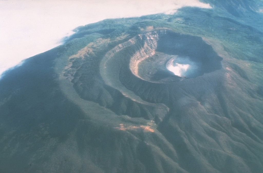
Volcano Santa Ana (Ilamatepec)
El Salvador's highest volcano, a broad stratovolcano in the west of the country beside Lake Coatepeque and the young cone of Izalco. Its summit crater holds a small acidic, turquoise lake that steams constantly. A sudden explosion in October 2005 hurled rocks and ash over the slopes, killed two people and forced thousands to evacuate; today it is a popular climb in Los Volcanes National Park.
Last eruption
Erupted since 2000
Summit
Stratovolcano · Andesite / Basaltic Andesite
Activity
0 events (1.0x rate)
Interactive Volcano & Seismicity Map
Seismicity within 50 km radius, active VAAC ash plumes, and tectonic plate boundaries.
Recent seismicity within 50 km
80 events in the last 12 h within 25 km of the crater.
| Time | Magnitude | Epicenter / Place | Distance |
|---|---|---|---|
| 4d ago | M2.5 | 26 km S of Jutiapa (Guatemala) | 32 km |
| 11d ago | M2.7 | 26 km S of Jutiapa (Guatemala) | 32 km |
| 12d ago | M3.9 | 60 km W of San Salvador (El Salvador) | 12 km |
| 22d ago | M2.8 | 81 km SE of Guatemala City (Guatemala) | 50 km |
| 26d ago | M3.1 | 65 km W of San Salvador (El Salvador) | 17 km |
| 26d ago | M3.0 | 64 km W of San Salvador (El Salvador) | 16 km |
| 2mo ago | M3.3 | Near San Salvador (El Salvador) | 48 km |
| 2mo ago | M3.4 | 26 km SE of Jutiapa (Guatemala) | 34 km |
Geological & Tectonic Profile
StratovolcanoSanta Ana (Ilamatepec) is an active Stratovolcano formed in an active Subduction zone / Continental crust (> 25 km). Dominant lithology: Andesite / Basaltic Andesite.
Volcano Dossier
VN #343020Official catalogue parameters, coordinates, elevation and geotectonic classification.
Authoritative Monitoring Infrastructure
Guatemala: Motagua Fault and Pacific Coast
Explore live seismic monitoring, historical danger benchmarks, fault slip models and recurrence intervals for Guatemala: Motagua Fault and Pacific Coast.
Open Regional HubFrequently Asked Questions (FAQ)
Verified scientific, operational, and emergency protocols
Catalogue: Smithsonian Institution, Global Volcanism Program.Smithsonian GVP profile