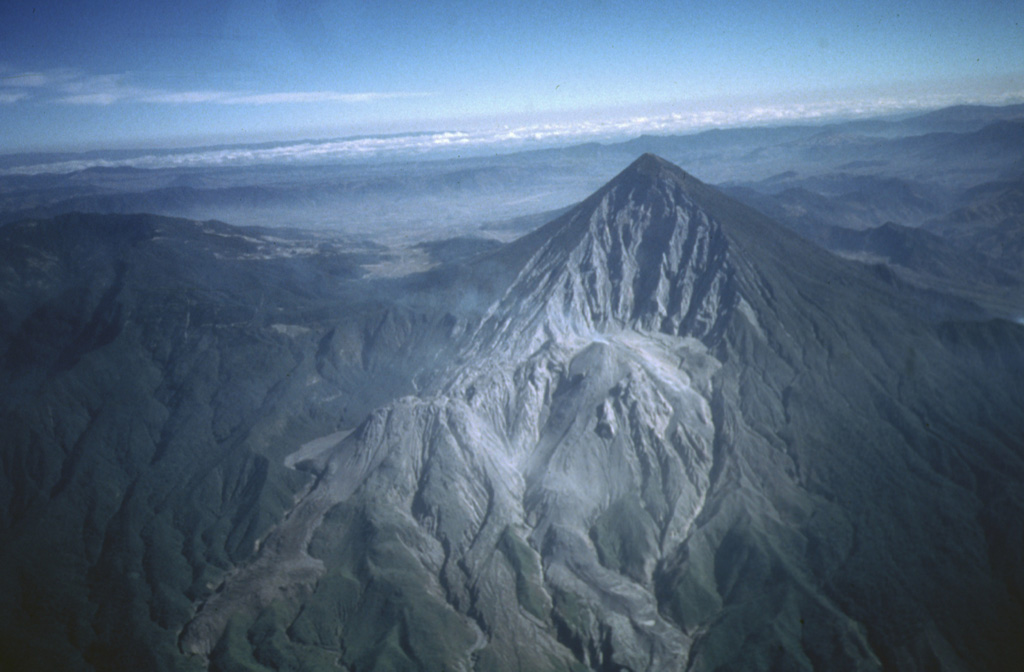
Volcano Santa María
Its October 1902 eruption, one of the three largest of the 20th century, tore open the mountain's flank and killed at least 5,000 people around Quetzaltenango. Since 1922 the Santiaguito lava domes have grown inside that scar, and they still puff out small explosions of ash many times a day.
Last Eruption
Erupted since 2000
Summit Elevation
Stratovolcano · Dacite
Seismic State
0 events (1.0x rate)
Interactive Volcano & Seismicity Map
Seismicity within 50 km radius, active VAAC ash plumes, and tectonic plate boundaries.
Recent seismicity within 50 km
0 events in the last 12 h within 25 km of the crater.
| Time | Magnitude | Epicenter / Place | Distance |
|---|---|---|---|
| 13d ago | M4.0 | GUATEMALA (INET) | 29 km |
| 14d ago | M4.0 | GUATEMALA (INET) | 41 km |
| 16d ago | M4.6 | 5 km E of San José El Ídolo, Guatemala | 39 km |
| 30d ago | M2.9 | GUATEMALA (INET) | 31 km |
| 43d ago | M3.0 | GUATEMALA (INET) | 32 km |
| 69d ago | M3.4 | GUATEMALA (INET) | 50 km |
| 71d ago | M4.3 | 4 km SW of Almolonga, Guatemala | 4.6 km |
Geological & Tectonic Profile
StratovolcanoSanta María is an active Stratovolcano formed in an active Subduction zone / Continental crust (> 25 km). Dominant lithology: Dacite.
Volcanic Dossier
VN #342030Official catalogue parameters, coordinates, elevation and geotectonic classification.
Authoritative Monitoring Infrastructure
Frequently Asked Questions (FAQ)
Verified scientific, operational, and emergency protocols
Catalogue: Smithsonian Institution, Global Volcanism Program.Smithsonian GVP profile