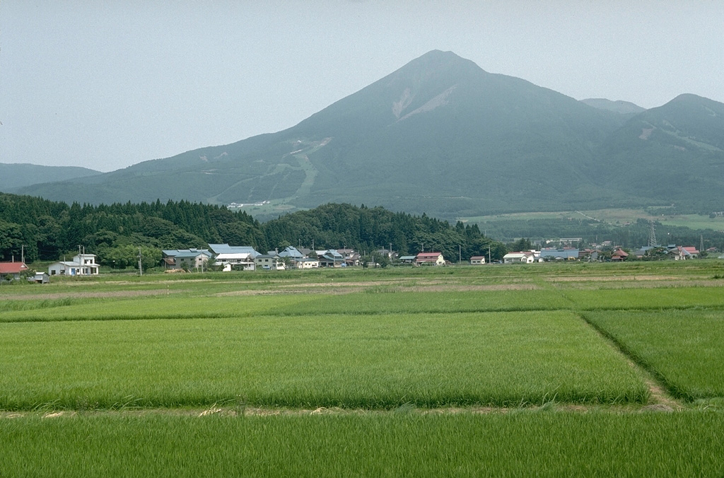
Volcano Bandai
On 15 July 1888 a steam-driven explosion blew out the north side of the mountain, sending an avalanche of debris over several villages and killing about 477 people. The rubble dammed rivers into hundreds of lakes and ponds, among them the vividly coloured Goshikinuma, and the collapse later became a key reference for understanding Mount St. Helens in 1980.
Last Eruption
Historical eruption
Summit Elevation
Stratovolcano · Andesite / Basaltic Andesite
Seismic State
0 events (1.0x rate)
Interactive Volcano & Seismicity Map
Seismicity within 50 km radius, active VAAC ash plumes, and tectonic plate boundaries.
Recent seismicity within 50 km
0 events in the last 12 h within 25 km of the crater.
| Time | Magnitude | Epicenter / Place | Distance |
|---|---|---|---|
| 43d ago | M2.5 | 福島県中通り, Japan | 34 km |
Geological & Tectonic Profile
StratovolcanoBandai is an active Stratovolcano formed in an active Subduction zone / Continental crust (> 25 km). Dominant lithology: Andesite / Basaltic Andesite.
Volcanic Dossier
VN #283160Official catalogue parameters, coordinates, elevation and geotectonic classification.
Authoritative Monitoring Infrastructure
Sanriku & Tohoku Coast
Explore live seismic monitoring, historical danger benchmarks, fault slip models and recurrence intervals for Sanriku & Tohoku Coast.
Open Regional HubFrequently Asked Questions (FAQ)
Verified scientific, operational, and emergency protocols
Catalogue: Smithsonian Institution, Global Volcanism Program.Smithsonian GVP profile