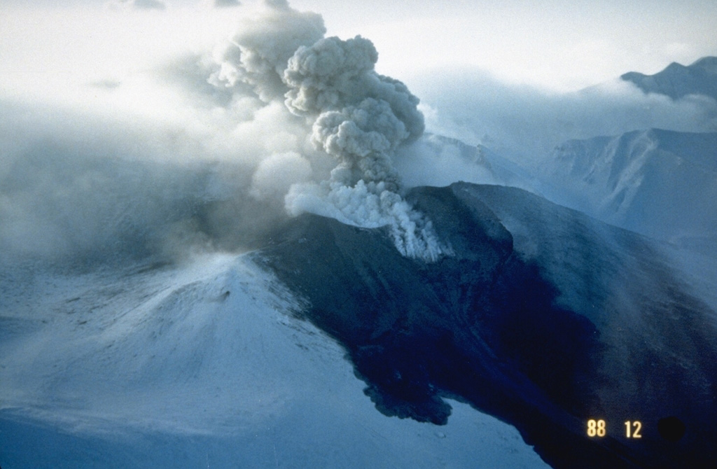
Volcano Núi Tokachi
Một trong những núi lửa hoạt động mạnh nhất Hokkaido. Tháng 5 năm 1926, một vụ phun trào nhỏ làm sụp một phần đỉnh núi và làm tan lớp tuyết; dòng bùn lao 25 km xuống các thị trấn nông nghiệp Kamifurano và Biei trong khoảng 25 phút, khiến 144 người thiệt mạng. Núi tiếp tục phun trào vào năm 1962 và 1988–89 và được giám sát suốt ngày đêm.
Last Eruption
Erupted since 2000
Summit Elevation
Núi lửa tầng (Stratovolcano) · Andesit / Andesit bazan
Seismic State
0 events (1.0x rate)
Interactive Volcano & Seismicity Map
Seismicity within 50 km radius, active VAAC ash plumes, and tectonic plate boundaries.
Recent seismicity within 50 km
0 events in the last 12 h within 25 km of the crater.
No catalogued earthquakes within 50 km in the last 90 days.
Geological & Tectonic Profile
Núi lửa tầng (Stratovolcano)Núi Tokachi is an active Stratovolcano(es) formed in an active Subduction zone / Continental crust (> 25 km). Dominant lithology: Andesite / Basaltic Andesite.
Volcanic Dossier
VN #285050Official catalogue parameters, coordinates, elevation and geotectonic classification.
Authoritative Monitoring Infrastructure
Đảo Hokkaido & Rãnh Kuril
Explore live seismic monitoring, historical danger benchmarks, fault slip models and recurrence intervals for Đảo Hokkaido & Rãnh Kuril.
Mở Trung tâm Khu vựcCâu hỏi thường gặp (FAQ)
Các quy trình khoa học, vận hành và ứng phó khẩn cấp đã được xác minh
Catalogue: Smithsonian Institution, Global Volcanism Program.Smithsonian GVP profile