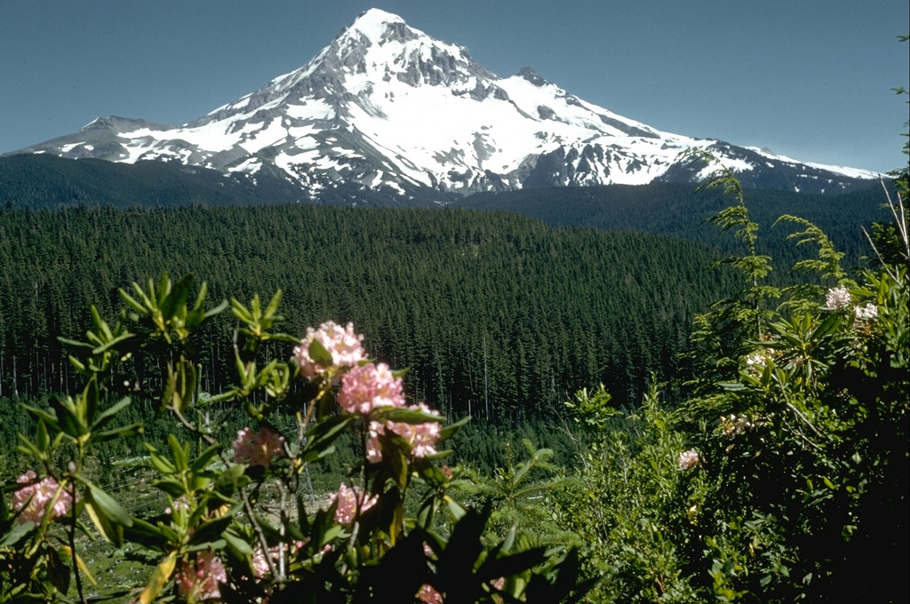
Volcano Núi Hood
Đỉnh núi cao nhất Oregon nằm cách Portland khoảng 80 km và được USGS xếp vào nhóm núi lửa có 'mối đe dọa rất cao'. Những lần phun trào đáng kể cuối cùng vào cuối thế kỷ 18 đã đưa các dòng bùn theo sông Sandy đổ ra sông Columbia; ngày nay các sông băng của núi cung cấp nước cho khu vực, sườn núi phủ kín đường trượt tuyết, và các đàn động đất nhỏ bên dưới thường xuyên nhắc nhở rằng nó vẫn còn hoạt động.
Last Eruption
Historical eruption
Summit Elevation
Núi lửa tầng (Stratovolcano) · Andesit / Andesit bazan
Seismic State
0 events (1.0x rate)
Interactive Volcano & Seismicity Map
Seismicity within 50 km radius, active VAAC ash plumes, and tectonic plate boundaries.
Recent seismicity within 50 km
0 events in the last 12 h within 25 km of the crater.
| Thời gian | Độ lớn | Tâm chấn / Địa điểm | Khoảng cách |
|---|---|---|---|
| 7d trước | M1.2 | 3 km S of Carson, Washington | 36 km |
| 8d trước | M0.8 | 6 km ENE of Government Camp, Oregon | 4.9 km |
| 8d trước | M0.9 | 8 km NNE of Government Camp, Oregon | 0.6 km |
| 9d trước | M1.1 | 6 km ENE of Government Camp, Oregon | 5.7 km |
| 23d trước | M0.8 | 9 km NNE of Government Camp, Oregon | 1.9 km |
| 28d trước | M0.1 | 6 km NE of Government Camp, Oregon | 4.1 km |
| 31d trước | M1.4 | 9 km NNE of Government Camp, Oregon | 0.9 km |
| 35d trước | M1.5 | 7 km NW of Mount Hood Village, Oregon | 28 km |
| 40d trước | M0.2 | 9 km NNE of Government Camp, Oregon | 0.3 km |
| 40d trước | M1.1 | 4 km ENE of Government Camp, Oregon | 6.1 km |
| 40d trước | M1.2 | 4 km ENE of Government Camp, Oregon | 6.1 km |
| 46d trước | M0.0 | 7 km ENE of Government Camp, Oregon | 5.3 km |
| 47d trước | M0.3 | 6 km NE of Government Camp, Oregon | 4.2 km |
| 62d trước | M0.9 | 3 km NW of Mount Hood Village, Oregon | 25 km |
| 70d trước | M0.1 | 8 km NNE of Government Camp, Oregon | 0.7 km |
| 71d trước | M0.2 | 8 km NE of Government Camp, Oregon | 0.6 km |
| 89d trước | M0.7 | 0 km N of Government Camp, Oregon | 8.4 km |
Geological & Tectonic Profile
Núi lửa tầng (Stratovolcano)Núi Hood is an active Stratovolcano formed in an active Subduction zone / Continental crust (> 25 km). Dominant lithology: Andesite / Basaltic Andesite.
Volcanic Dossier
VN #322010Official catalogue parameters, coordinates, elevation and geotectonic classification.
Authoritative Monitoring Infrastructure
Đới hút chìm Cascadia & Tây Bắc Thái Bình Dương
Explore live seismic monitoring, historical danger benchmarks, fault slip models and recurrence intervals for Đới hút chìm Cascadia & Tây Bắc Thái Bình Dương.
Mở Trung tâm Khu vựcCâu hỏi thường gặp (FAQ)
Các quy trình khoa học, vận hành và ứng phó khẩn cấp đã được xác minh
Catalogue: Smithsonian Institution, Global Volcanism Program.Smithsonian GVP profile