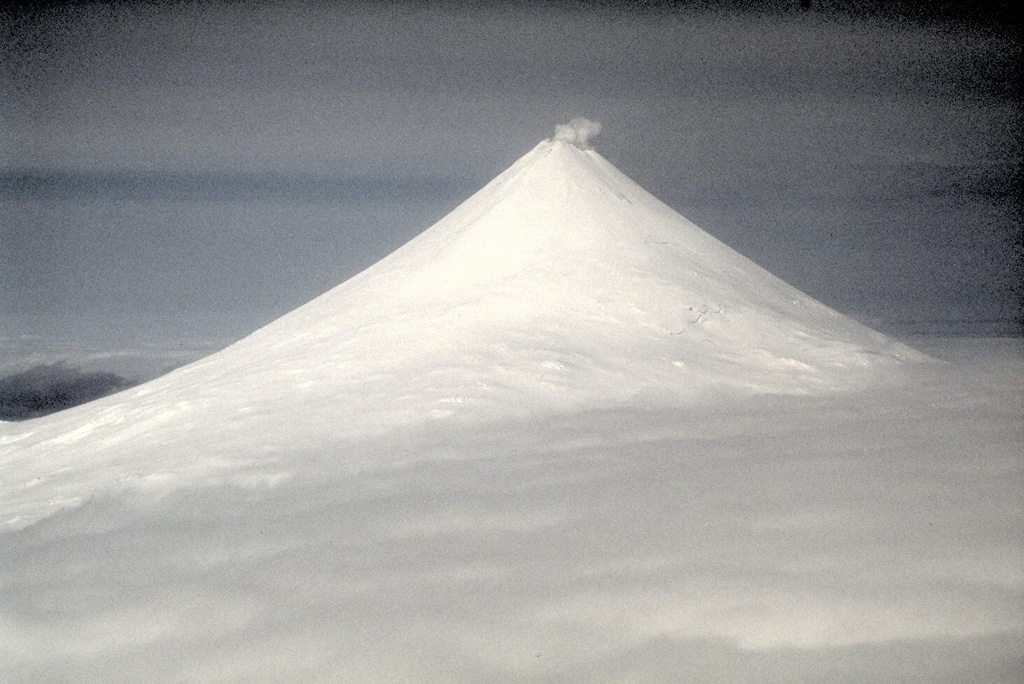
Volcano Shishaldin
The symmetrical snow-covered cone at the heart of Unimak Island in the Aleutians and one of the most active volcanoes in the arc. In 2023 it produced more than a dozen explosive episodes whose ash clouds reached the North Pacific flight routes between North America and Asia.
Last eruption
Erupted since 2000
Summit
Stratovolcano · Basalt / Picro-Basalt
Activity
0 events (1.0x rate)
Interactive Volcano & Seismicity Map
Seismicity within 50 km radius, active VAAC ash plumes, and tectonic plate boundaries.
Recent seismicity within 50 km
0 events in the last 12 h within 25 km of the crater.
| Time | Magnitude | Epicenter / Place | Distance |
|---|---|---|---|
| 5d ago | M1.4 | 42 km W of False Pass, Alaska | 9.0 km |
| 5d ago | M1.1 | 21 km WSW of False Pass, Alaska | 17 km |
| 8d ago | M1.3 | 59 km WSW of False Pass, Alaska | 23 km |
| 12d ago | M2.4 | 29 km WSW of False Pass, Alaska | 8.4 km |
| 13d ago | M3.7 | 35 km SW of False Pass, Alaska | 17 km |
| 13d ago | M1.8 | 58 km WSW of False Pass, Alaska | 22 km |
| 20d ago | M2.5 | 60 km SSW of False Pass, Alaska | 42 km |
| 29d ago | M1.4 | 56 km WSW of False Pass, Alaska | 20 km |
| 31d ago | M1.8 | 27 km SSW of False Pass, Alaska | 31 km |
| 37d ago | M1.5 | 27 km SSW of False Pass, Alaska | 30 km |
| 38d ago | M2.1 | 35 km SSW of False Pass, Alaska | 37 km |
| 38d ago | M1.2 | 38 km WSW of False Pass, Alaska | 4.9 km |
| 42d ago | M2.5 | 22 km WNW of False Pass, Alaska | 27 km |
| 51d ago | M1.2 | 35 km SSW of False Pass, Alaska | 37 km |
| 51d ago | M0.8 | 49 km WSW of False Pass, Alaska | 12 km |
| 54d ago | M2.1 | 25 km S of False Pass, Alaska | 39 km |
| 56d ago | M2.4 | 18 km SW of False Pass, Alaska | 24 km |
| 56d ago | M1.8 | 16 km SW of False Pass, Alaska | 23 km |
| 61d ago | M2.0 | 45 km SSW of False Pass, Alaska | 31 km |
| 64d ago | M0.8 | 28 km S of False Pass, Alaska | 35 km |
| 64d ago | M0.4 | 86 km ENE of Akutan, Alaska | 50 km |
| 75d ago | M1.5 | 79 km WSW of False Pass, Alaska | 42 km |
| 78d ago | M0.5 | 84 km WSW of False Pass, Alaska | 48 km |
| 86d ago | M1.9 | 31 km SSW of False Pass, Alaska | 33 km |
| 86d ago | M2.3 | 30 km SSW of False Pass, Alaska | 34 km |
Geological & Tectonic Profile
StratovolcanoShishaldin is an active Stratovolcano formed in an active Subduction zone / Continental crust (> 25 km). Dominant lithology: Basalt / Picro-Basalt.
Volcano Dossier
VN #311360Official catalogue parameters, coordinates, elevation and geotectonic classification.
Authoritative Monitoring Infrastructure
Alaska & Aleutian Arc
Explore live seismic monitoring, historical danger benchmarks, fault slip models and recurrence intervals for Alaska & Aleutian Arc.
Open Regional HubFrequently Asked Questions (FAQ)
Verified scientific, operational, and emergency protocols
Catalogue: Smithsonian Institution, Global Volcanism Program.Smithsonian GVP profile