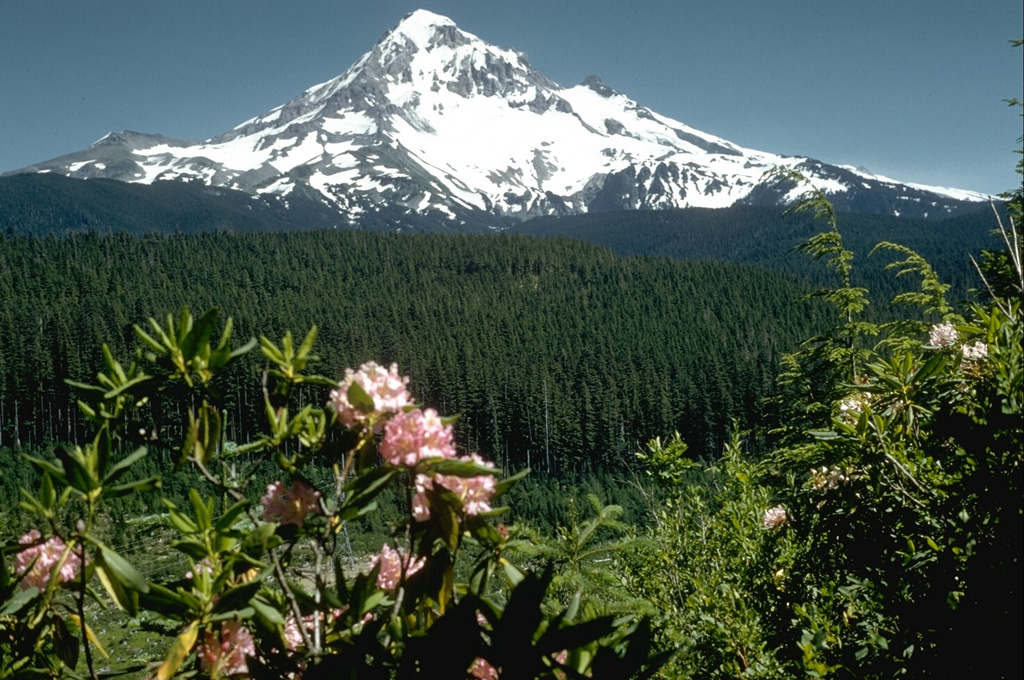
Volcano Mount Hood
Oregon's highest peak stands about 80 km from Portland and is rated a 'very high threat' volcano by the USGS. Its last significant eruptions, in the late 1700s, sent mudflows down the Sandy River to the Columbia; today its glaciers feed the region's water supply, ski runs cover its flanks, and small earthquake swarms beneath it are a routine reminder that it is still active.
Last Eruption
Historical eruption
Summit Elevation
Stratovolcano · Andesite / Basaltic Andesite
Seismic State
0 events (1.0x rate)
Interactive Volcano & Seismicity Map
Seismicity within 50 km radius, active VAAC ash plumes, and tectonic plate boundaries.
Recent seismicity within 50 km
0 events in the last 12 h within 25 km of the crater.
| Time | Magnitude | Epicenter / Place | Distance |
|---|---|---|---|
| 7d ago | M1.2 | 3 km S of Carson, Washington | 36 km |
| 8d ago | M0.8 | 6 km ENE of Government Camp, Oregon | 4.9 km |
| 8d ago | M0.9 | 8 km NNE of Government Camp, Oregon | 0.6 km |
| 9d ago | M1.1 | 6 km ENE of Government Camp, Oregon | 5.7 km |
| 23d ago | M0.8 | 9 km NNE of Government Camp, Oregon | 1.9 km |
| 28d ago | M0.1 | 6 km NE of Government Camp, Oregon | 4.1 km |
| 31d ago | M1.4 | 9 km NNE of Government Camp, Oregon | 0.9 km |
| 35d ago | M1.5 | 7 km NW of Mount Hood Village, Oregon | 28 km |
| 40d ago | M0.2 | 9 km NNE of Government Camp, Oregon | 0.3 km |
| 40d ago | M1.1 | 4 km ENE of Government Camp, Oregon | 6.1 km |
| 40d ago | M1.2 | 4 km ENE of Government Camp, Oregon | 6.1 km |
| 46d ago | M0.0 | 7 km ENE of Government Camp, Oregon | 5.3 km |
| 47d ago | M0.3 | 6 km NE of Government Camp, Oregon | 4.2 km |
| 62d ago | M0.9 | 3 km NW of Mount Hood Village, Oregon | 25 km |
| 70d ago | M0.1 | 8 km NNE of Government Camp, Oregon | 0.7 km |
| 71d ago | M0.2 | 8 km NE of Government Camp, Oregon | 0.6 km |
| 89d ago | M0.7 | 0 km N of Government Camp, Oregon | 8.4 km |
Geological & Tectonic Profile
StratovolcanoMount Hood is an active Stratovolcano formed in an active Subduction zone / Continental crust (> 25 km). Dominant lithology: Andesite / Basaltic Andesite.
Volcanic Dossier
VN #322010Official catalogue parameters, coordinates, elevation and geotectonic classification.
Authoritative Monitoring Infrastructure
Cascadia & Pacific Northwest
Explore live seismic monitoring, historical danger benchmarks, fault slip models and recurrence intervals for Cascadia & Pacific Northwest.
Open Regional HubFrequently Asked Questions (FAQ)
Verified scientific, operational, and emergency protocols
Catalogue: Smithsonian Institution, Global Volcanism Program.Smithsonian GVP profile