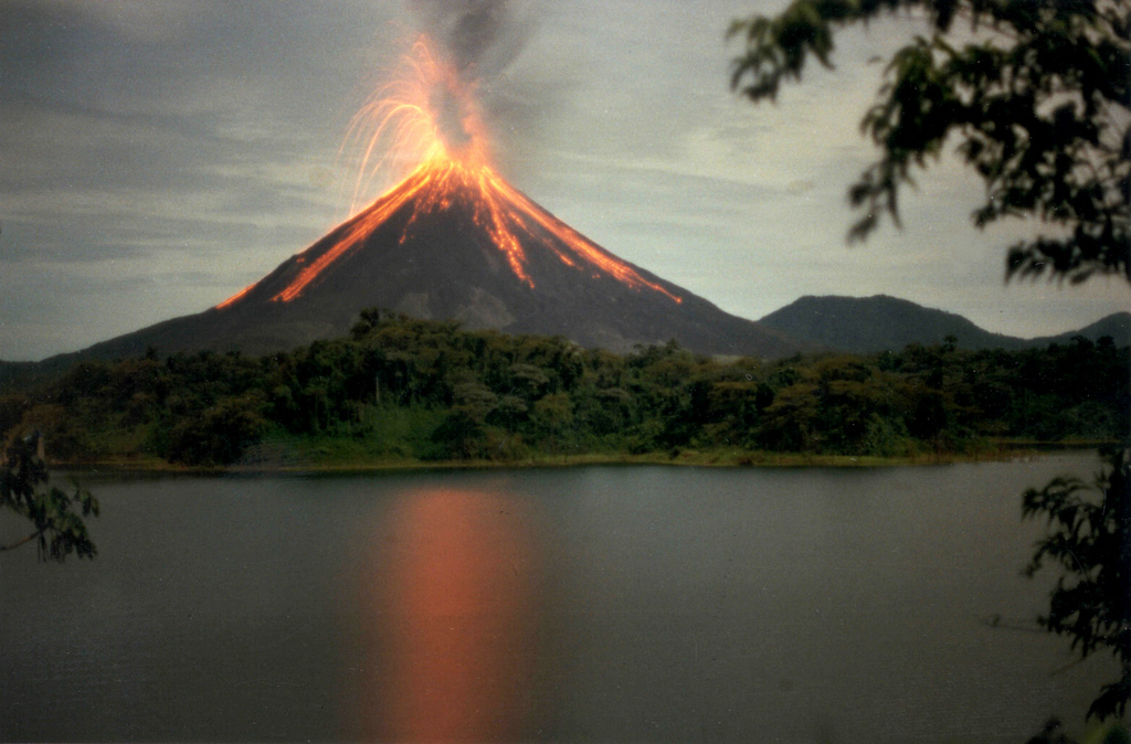
Volcano Arenal
Thought to be extinct until July 1968, when an eruption buried three villages and killed 87 people. Arenal then erupted continuously for 42 years, becoming Costa Rica's best-known volcano and the centre of a national park, before falling quiet in 2010.
Last eruption
Erupted since 2000
Summit
Stratovolcano · Andesite / Basaltic Andesite
Activity
0 events (1.0x rate)
Interactive Volcano & Seismicity Map
Seismicity within 50 km radius, active VAAC ash plumes, and tectonic plate boundaries.
Recent seismicity within 50 km
130 events in the last 12 h within 25 km of the crater.
| Time | Magnitude | Epicenter / Place | Distance |
|---|---|---|---|
| 1d ago | M3.0 | 79 km NW of San José (Costa Rica) | 11 km |
| 2d ago | M3.0 | 69 km W of San José (Costa Rica) | 37 km |
| 9d ago | M2.9 | 50 km N of Puntarenas (Costa Rica) | 24 km |
| 1mo ago | M2.8 | 86 km NW of San José (Costa Rica) | 3.1 km |
| 1mo ago | M3.1 | 46 km NW of San José (Costa Rica) | 44 km |
| 1mo ago | M2.7 | 54 km NW of San José (Costa Rica) | 36 km |
| 1mo ago | M3.3 | 69 km NW of San José (Costa Rica) | 35 km |
| 1mo ago | M2.6 | 62 km N of San José (Costa Rica) | 44 km |
| 1mo ago | M3.0 | 69 km W of San José (Costa Rica) | 32 km |
| 2mo ago | M2.8 | 39 km NW of Puntarenas (Costa Rica) | 44 km |
| 2mo ago | M2.7 | 49 km N of Puntarenas (Costa Rica) | 21 km |
| 2mo ago | M3.4 | 88 km NW of San José (Costa Rica) | 28 km |
| 2mo ago | M3.3 | 79 km N of Alajuela (Costa Rica) | 37 km |
Geological & Tectonic Profile
StratovolcanoArenal is an active Stratovolcano formed in an active Subduction zone / Continental crust (> 25 km). Dominant lithology: Andesite / Basaltic Andesite.
Volcano Dossier
VN #345033Official catalogue parameters, coordinates, elevation and geotectonic classification.
Authoritative Monitoring Infrastructure
Nicoya and the Central Valley
Explore live seismic monitoring, historical danger benchmarks, fault slip models and recurrence intervals for Nicoya and the Central Valley.
Open Regional HubFrequently Asked Questions (FAQ)
Verified scientific, operational, and emergency protocols
Catalogue: Smithsonian Institution, Global Volcanism Program.Smithsonian GVP profile