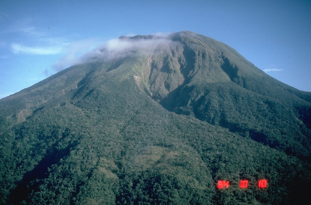
Volcano Bulusan
Le volcan le plus méridional de Luçon s'élève au-dessus de la forêt tropicale et de lacs de cratère dans la province de Sorsogon. Le Bulusan est connu pour ses explosions de vapeur soudaines, qui surviennent presque sans signe avant-coureur ; son dernier regain d'activité, en 2025, a saupoudré de cendres les bourgs agricoles alentour et maintenu fermée la zone de danger permanente de 4 km autour du sommet.
Last Eruption
Erupted since 2000
Summit Elevation
Stratovolcan · Andésite / Andésite basaltique
Seismic State
0 events (1.0x rate)
Interactive Volcano & Seismicity Map
Seismicity within 50 km radius, active VAAC ash plumes, and tectonic plate boundaries.
Recent seismicity within 50 km
0 events in the last 12 h within 25 km of the crater.
| Heure | Magnitude | Épicentre / lieu | Distance |
|---|---|---|---|
| 3d il y a | M1.8 | 007 km S 52° E of City Of Legazpi (Albay) | 47 km |
| 16d il y a | M1.6 | 003 km S 74° W of City Of Sorsogon (Sorsogon) | 23 km |
| 17d il y a | M2.3 | 013 km S 78° E of Manito (Albay) | 37 km |
| 17d il y a | M2.1 | 012 km N 78° E of Manito (Albay) | 42 km |
| 17d il y a | M2.6 | 022 km S 83° E of Prieto Diaz (Sorsogon) | 46 km |
| 22d il y a | M2.4 | 004 km N 36° W of Batuan (Masbate) | 48 km |
| 22d il y a | M2.4 | 005 km N 82° E of San Jacinto (Masbate) | 37 km |
| 22d il y a | M1.8 | 004 km S 28° W of Monreal (Masbate) | 48 km |
| 26d il y a | M2.0 | 014 km S 67° E of Barcelona (Sorsogon) | 24 km |
| 28d il y a | M1.6 | 008 km N 01° E of Prieto Diaz (Sorsogon) | 41 km |
| 34d il y a | M2.0 | 008 km N 22° W of Monreal (Masbate) | 46 km |
| 38d il y a | M1.5 | 003 km N 31° E of City Of Sorsogon (Sorsogon) | 26 km |
| 38d il y a | M1.6 | 004 km S 83° E of Biri (Northern Samar) | 39 km |
| 39d il y a | M2.0 | 016 km N 40° E of Prieto Diaz (Sorsogon) | 49 km |
| 39d il y a | M2.6 | 003 km S 81° W of Rosario (Northern Samar) | 46 km |
| 41d il y a | M2.7 | 006 km N 39° W of Prieto Diaz (Sorsogon) | 37 km |
| 41d il y a | M1.7 | 001 km S 29° E of San Fernando (Masbate) | 45 km |
| 45d il y a | M1.6 | 012 km N 81° E of Prieto Diaz (Sorsogon) | 42 km |
| 46d il y a | M1.6 | 009 km N 40° W of Prieto Diaz (Sorsogon) | 38 km |
| 49d il y a | M2.5 | 009 km N 09° E of Prieto Diaz (Sorsogon) | 42 km |
| 49d il y a | M1.7 | 009 km S 15° W of Manito (Albay) | 38 km |
| 51d il y a | M2.1 | 004 km N 40° W of Lavezares (Northern Samar) | 36 km |
| 55d il y a | M2.7 | 005 km S 86° W of San Fernando (Masbate) | 49 km |
| 58d il y a | M3.4 | CATANDUANES, PHILIPPINES (PIVS) | 34 km |
Geological & Tectonic Profile
StratovolcanBulusan is an active Stratovolcano(es) formed in an active Subduction zone / Continental crust (> 25 km). Dominant lithology: Andesite / Basaltic Andesite.
Volcanic Dossier
VN #273010Official catalogue parameters, coordinates, elevation and geotectonic classification.
Authoritative Monitoring Infrastructure
Luçon et vallée de Manille
Explore live seismic monitoring, historical danger benchmarks, fault slip models and recurrence intervals for Luçon et vallée de Manille.
Ouvrir le pôle régionalQuestions fréquentes (FAQ)
Protocoles scientifiques, opérationnels et d’urgence vérifiés
Catalogue: Smithsonian Institution, Global Volcanism Program.Smithsonian GVP profile