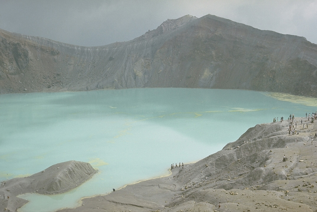
Volcano Kusatsu-Shirane
Di atas pemandian air panas Kusatsu yang terkenal terdapat Yugama, danau kawah berwarna pirus yang termasuk paling asam di Bumi. Pada Januari 2018 kerucut Moto-Shirane, yang dianggap tenang selama ribuan tahun, meletus tanpa peringatan di atas sebuah resor ski dan menghujani gondola serta tentara yang berlatih di lereng dengan batu; satu orang tewas dan sebelas terluka.
Last Eruption
Erupted since 2000
Summit Elevation
Stratovulkan · Andesit / Andesit basal
Seismic State
0 events (1.0x rate)
Interactive Volcano & Seismicity Map
Seismicity within 50 km radius, active VAAC ash plumes, and tectonic plate boundaries.
Recent seismicity within 50 km
0 events in the last 12 h within 25 km of the crater.
No catalogued earthquakes within 50 km in the last 90 days.
Geological & Tectonic Profile
StratovulkanKusatsu-Shirane is an active Stratovolcano(es) formed in an active Subduction zone / Continental crust (> 25 km). Dominant lithology: Andesite / Basaltic Andesite.
Volcanic Dossier
VN #283120Official catalogue parameters, coordinates, elevation and geotectonic classification.
Authoritative Monitoring Infrastructure
Tokyo & Dataran Kanto
Explore live seismic monitoring, historical danger benchmarks, fault slip models and recurrence intervals for Tokyo & Dataran Kanto.
Buka Pusat RegionalPertanyaan yang Sering Diajukan (FAQ)
Protokol ilmiah, operasional, dan darurat terverifikasi
Catalogue: Smithsonian Institution, Global Volcanism Program.Smithsonian GVP profile