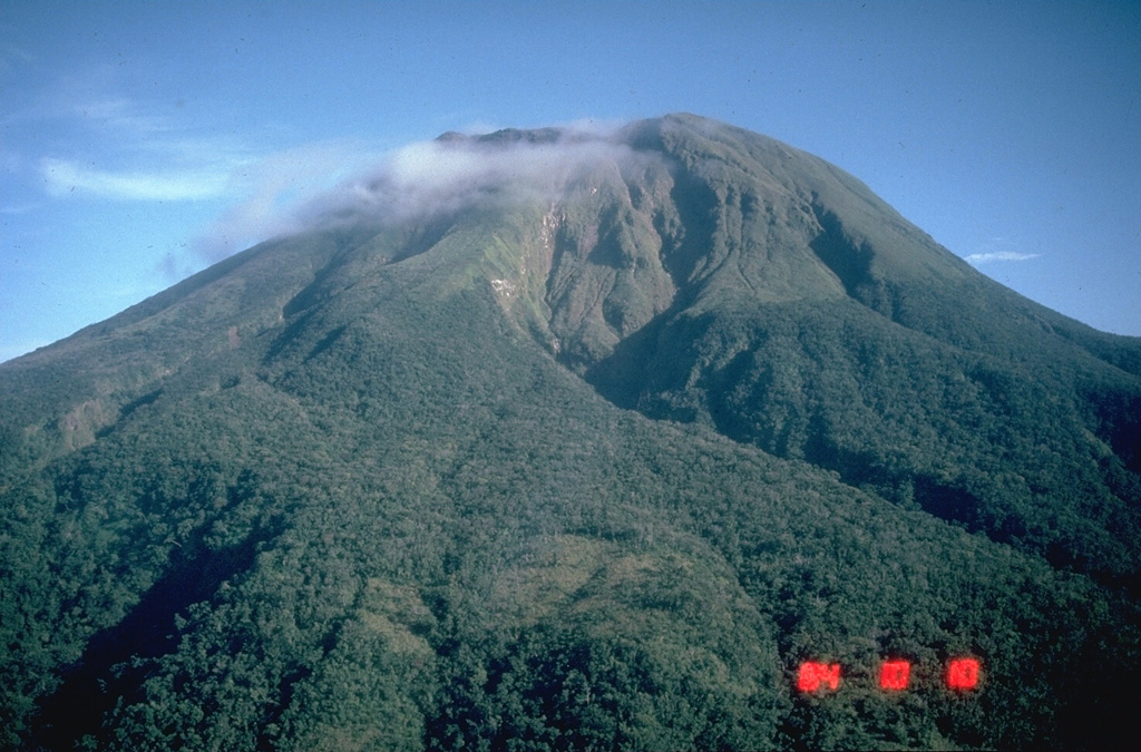
Volcano Bulusan
Gunung api paling selatan di Luzon ini menjulang di atas hutan hujan dan danau kawah di provinsi Sorsogon. Bulusan dikenal dengan letusan uap mendadak yang datang hampir tanpa peringatan; aktivitas terbarunya pada 2025 menaburkan abu ke kota-kota pertanian di sekitarnya dan zona bahaya permanen 4 km di sekitar puncaknya tetap ditutup.
Last Eruption
Erupted since 2000
Summit Elevation
Stratovulkan · Andesit / Andesit basal
Seismic State
0 events (1.0x rate)
Interactive Volcano & Seismicity Map
Seismicity within 50 km radius, active VAAC ash plumes, and tectonic plate boundaries.
Recent seismicity within 50 km
0 events in the last 12 h within 25 km of the crater.
| Waktu | Magnitudo | Episenter / Lokasi | Jarak |
|---|---|---|---|
| 3d yang lalu | M1.8 | 007 km S 52° E of City Of Legazpi (Albay) | 47 km |
| 16d yang lalu | M1.6 | 003 km S 74° W of City Of Sorsogon (Sorsogon) | 23 km |
| 17d yang lalu | M2.3 | 013 km S 78° E of Manito (Albay) | 37 km |
| 17d yang lalu | M2.1 | 012 km N 78° E of Manito (Albay) | 42 km |
| 18d yang lalu | M2.6 | 022 km S 83° E of Prieto Diaz (Sorsogon) | 46 km |
| 22d yang lalu | M2.4 | 004 km N 36° W of Batuan (Masbate) | 48 km |
| 22d yang lalu | M2.4 | 005 km N 82° E of San Jacinto (Masbate) | 37 km |
| 22d yang lalu | M1.8 | 004 km S 28° W of Monreal (Masbate) | 48 km |
| 27d yang lalu | M2.0 | 014 km S 67° E of Barcelona (Sorsogon) | 24 km |
| 28d yang lalu | M1.6 | 008 km N 01° E of Prieto Diaz (Sorsogon) | 41 km |
| 34d yang lalu | M2.0 | 008 km N 22° W of Monreal (Masbate) | 46 km |
| 38d yang lalu | M1.5 | 003 km N 31° E of City Of Sorsogon (Sorsogon) | 26 km |
| 39d yang lalu | M1.6 | 004 km S 83° E of Biri (Northern Samar) | 39 km |
| 39d yang lalu | M2.0 | 016 km N 40° E of Prieto Diaz (Sorsogon) | 49 km |
| 39d yang lalu | M2.6 | 003 km S 81° W of Rosario (Northern Samar) | 46 km |
| 41d yang lalu | M2.7 | 006 km N 39° W of Prieto Diaz (Sorsogon) | 37 km |
| 41d yang lalu | M1.7 | 001 km S 29° E of San Fernando (Masbate) | 45 km |
| 45d yang lalu | M1.6 | 012 km N 81° E of Prieto Diaz (Sorsogon) | 42 km |
| 46d yang lalu | M1.6 | 009 km N 40° W of Prieto Diaz (Sorsogon) | 38 km |
| 49d yang lalu | M2.5 | 009 km N 09° E of Prieto Diaz (Sorsogon) | 42 km |
| 49d yang lalu | M1.7 | 009 km S 15° W of Manito (Albay) | 38 km |
| 51d yang lalu | M2.1 | 004 km N 40° W of Lavezares (Northern Samar) | 36 km |
| 55d yang lalu | M2.7 | 005 km S 86° W of San Fernando (Masbate) | 49 km |
| 58d yang lalu | M3.4 | CATANDUANES, PHILIPPINES (PIVS) | 34 km |
Geological & Tectonic Profile
StratovulkanBulusan is an active Stratovolcano(es) formed in an active Subduction zone / Continental crust (> 25 km). Dominant lithology: Andesite / Basaltic Andesite.
Volcanic Dossier
VN #273010Official catalogue parameters, coordinates, elevation and geotectonic classification.
Authoritative Monitoring Infrastructure
Luzon & Lembah Manila
Explore live seismic monitoring, historical danger benchmarks, fault slip models and recurrence intervals for Luzon & Lembah Manila.
Buka Pusat RegionalPertanyaan yang Sering Diajukan (FAQ)
Protokol ilmiah, operasional, dan darurat terverifikasi
Catalogue: Smithsonian Institution, Global Volcanism Program.Smithsonian GVP profile