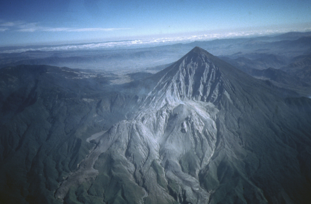
Volcano Santa María
Su erupción de octubre de 1902, una de las tres mayores del siglo XX, abrió un tajo en el flanco de la montaña y mató al menos a 5.000 personas en torno a Quetzaltenango. Desde 1922 los domos de lava del Santiaguito crecen dentro de esa cicatriz y todavía lanzan pequeñas explosiones de ceniza muchas veces al día.
Last Eruption
Erupted since 2000
Summit Elevation
Estratovolcán · Dacita
Seismic State
0 events (1.0x rate)
Interactive Volcano & Seismicity Map
Seismicity within 50 km radius, active VAAC ash plumes, and tectonic plate boundaries.
Recent seismicity within 50 km
0 events in the last 12 h within 25 km of the crater.
| Hora | Magnitud | Epicentro / Ubicación | Distancia |
|---|---|---|---|
| 13d hace | M4.0 | GUATEMALA (INET) | 29 km |
| 14d hace | M4.0 | GUATEMALA (INET) | 41 km |
| 16d hace | M4.6 | 5 km E of San José El Ídolo, Guatemala | 39 km |
| 30d hace | M2.9 | GUATEMALA (INET) | 31 km |
| 43d hace | M3.0 | GUATEMALA (INET) | 32 km |
| 69d hace | M3.4 | GUATEMALA (INET) | 50 km |
| 71d hace | M4.3 | 4 km SW of Almolonga, Guatemala | 4.6 km |
Geological & Tectonic Profile
EstratovolcánSanta María is an active Stratovolcano formed in an active Subduction zone / Continental crust (> 25 km). Dominant lithology: Dacite.
Volcanic Dossier
VN #342030Official catalogue parameters, coordinates, elevation and geotectonic classification.
Authoritative Monitoring Infrastructure
Preguntas Frecuentes (FAQ)
Protocolos científicos, operativos y de emergencia verificados
Catalogue: Smithsonian Institution, Global Volcanism Program.Smithsonian GVP profile