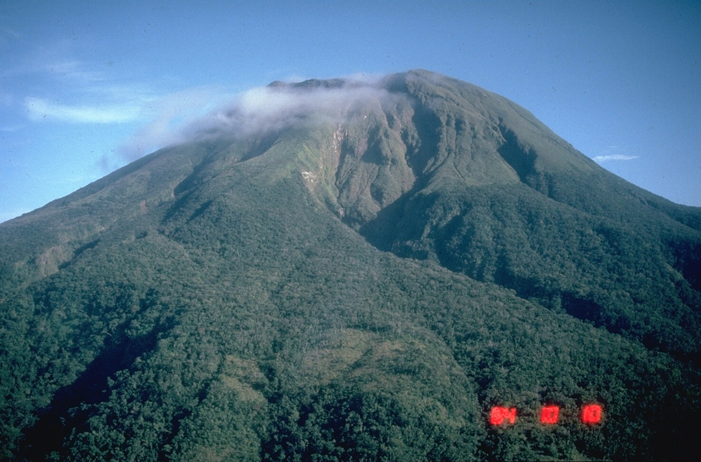
Volcano 布卢桑火山
布卢桑火山是吕宋岛最南端的火山,耸立在索索贡省的雨林和火山口湖之上。它以几乎毫无预兆的突发蒸汽爆炸而闻名;2025年的最新一轮活动使周边农业城镇落满火山灰,山顶周围4公里的永久危险区持续封闭。
Last Eruption
Erupted since 2000
Summit Elevation
复合成层火山 · 安山岩 / 玄武安山岩
Seismic State
0 events (1.0x rate)
Interactive Volcano & Seismicity Map
Seismicity within 50 km radius, active VAAC ash plumes, and tectonic plate boundaries.
Recent seismicity within 50 km
0 events in the last 12 h within 25 km of the crater.
| 时间 | 震级 | 震中 / 地点 | 距离 |
|---|---|---|---|
| 3d 前 | M1.8 | 007 km S 52° E of City Of Legazpi (Albay) | 47 km |
| 16d 前 | M1.6 | 003 km S 74° W of City Of Sorsogon (Sorsogon) | 23 km |
| 17d 前 | M2.3 | 013 km S 78° E of Manito (Albay) | 37 km |
| 17d 前 | M2.1 | 012 km N 78° E of Manito (Albay) | 42 km |
| 18d 前 | M2.6 | 022 km S 83° E of Prieto Diaz (Sorsogon) | 46 km |
| 22d 前 | M2.4 | 004 km N 36° W of Batuan (Masbate) | 48 km |
| 22d 前 | M2.4 | 005 km N 82° E of San Jacinto (Masbate) | 37 km |
| 22d 前 | M1.8 | 004 km S 28° W of Monreal (Masbate) | 48 km |
| 27d 前 | M2.0 | 014 km S 67° E of Barcelona (Sorsogon) | 24 km |
| 28d 前 | M1.6 | 008 km N 01° E of Prieto Diaz (Sorsogon) | 41 km |
| 34d 前 | M2.0 | 008 km N 22° W of Monreal (Masbate) | 46 km |
| 38d 前 | M1.5 | 003 km N 31° E of City Of Sorsogon (Sorsogon) | 26 km |
| 39d 前 | M1.6 | 004 km S 83° E of Biri (Northern Samar) | 39 km |
| 39d 前 | M2.0 | 016 km N 40° E of Prieto Diaz (Sorsogon) | 49 km |
| 39d 前 | M2.6 | 003 km S 81° W of Rosario (Northern Samar) | 46 km |
| 41d 前 | M2.7 | 006 km N 39° W of Prieto Diaz (Sorsogon) | 37 km |
| 41d 前 | M1.7 | 001 km S 29° E of San Fernando (Masbate) | 45 km |
| 45d 前 | M1.6 | 012 km N 81° E of Prieto Diaz (Sorsogon) | 42 km |
| 46d 前 | M1.6 | 009 km N 40° W of Prieto Diaz (Sorsogon) | 38 km |
| 49d 前 | M2.5 | 009 km N 09° E of Prieto Diaz (Sorsogon) | 42 km |
| 49d 前 | M1.7 | 009 km S 15° W of Manito (Albay) | 38 km |
| 51d 前 | M2.1 | 004 km N 40° W of Lavezares (Northern Samar) | 36 km |
| 55d 前 | M2.7 | 005 km S 86° W of San Fernando (Masbate) | 49 km |
| 58d 前 | M3.4 | CATANDUANES, PHILIPPINES (PIVS) | 34 km |
Geological & Tectonic Profile
复合成层火山布卢桑火山 is an active Stratovolcano(es) formed in an active Subduction zone / Continental crust (> 25 km). Dominant lithology: Andesite / Basaltic Andesite.
Volcanic Dossier
VN #273010Official catalogue parameters, coordinates, elevation and geotectonic classification.
Authoritative Monitoring Infrastructure
吕宋岛与马尼拉谷地
Explore live seismic monitoring, historical danger benchmarks, fault slip models and recurrence intervals for 吕宋岛与马尼拉谷地.
打开区域监控中心常见问题(FAQ)
经过验证的科学、运行与应急规程
Catalogue: Smithsonian Institution, Global Volcanism Program.Smithsonian GVP profile