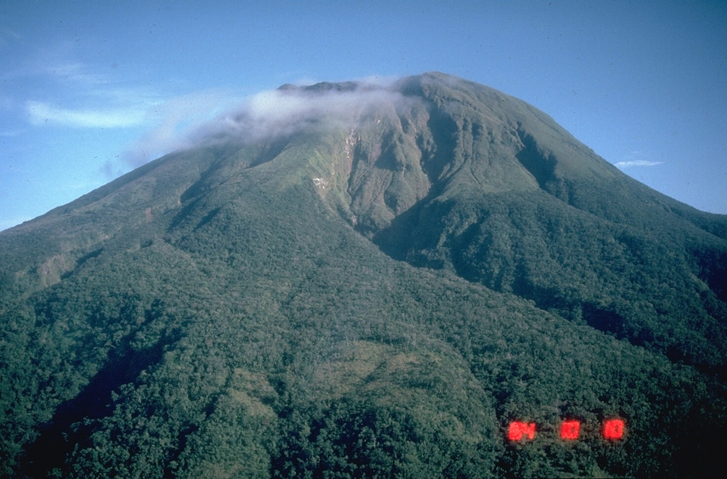
Volcano Bulusan
Luzon'un en güneydeki volkanı Sorsogon ilinde yağmur ormanlarının ve krater göllerinin üzerinde yükselir. Bulusan, neredeyse hiç uyarı vermeden gelen ani buhar patlamalarıyla bilinir; 2025'teki son etkinlik dönemi çevredeki tarım kasabalarını küle buladı ve zirve çevresindeki kalıcı 4 km'lik tehlike bölgesi kapalı tutuldu.
Last Eruption
Erupted since 2000
Summit Elevation
Stratovolkan · Andezit / Bazaltik andezit
Seismic State
0 events (1.0x rate)
Interactive Volcano & Seismicity Map
Seismicity within 50 km radius, active VAAC ash plumes, and tectonic plate boundaries.
Recent seismicity within 50 km
0 events in the last 12 h within 25 km of the crater.
| Zaman | Büyüklük | Merkez Üssü / Konum | Mesafe |
|---|---|---|---|
| 3d önce | M1.8 | 007 km S 52° E of City Of Legazpi (Albay) | 47 km |
| 16d önce | M1.6 | 003 km S 74° W of City Of Sorsogon (Sorsogon) | 23 km |
| 17d önce | M2.3 | 013 km S 78° E of Manito (Albay) | 37 km |
| 17d önce | M2.1 | 012 km N 78° E of Manito (Albay) | 42 km |
| 17d önce | M2.6 | 022 km S 83° E of Prieto Diaz (Sorsogon) | 46 km |
| 22d önce | M2.4 | 004 km N 36° W of Batuan (Masbate) | 48 km |
| 22d önce | M2.4 | 005 km N 82° E of San Jacinto (Masbate) | 37 km |
| 22d önce | M1.8 | 004 km S 28° W of Monreal (Masbate) | 48 km |
| 26d önce | M2.0 | 014 km S 67° E of Barcelona (Sorsogon) | 24 km |
| 28d önce | M1.6 | 008 km N 01° E of Prieto Diaz (Sorsogon) | 41 km |
| 34d önce | M2.0 | 008 km N 22° W of Monreal (Masbate) | 46 km |
| 38d önce | M1.5 | 003 km N 31° E of City Of Sorsogon (Sorsogon) | 26 km |
| 38d önce | M1.6 | 004 km S 83° E of Biri (Northern Samar) | 39 km |
| 39d önce | M2.0 | 016 km N 40° E of Prieto Diaz (Sorsogon) | 49 km |
| 39d önce | M2.6 | 003 km S 81° W of Rosario (Northern Samar) | 46 km |
| 41d önce | M2.7 | 006 km N 39° W of Prieto Diaz (Sorsogon) | 37 km |
| 41d önce | M1.7 | 001 km S 29° E of San Fernando (Masbate) | 45 km |
| 45d önce | M1.6 | 012 km N 81° E of Prieto Diaz (Sorsogon) | 42 km |
| 46d önce | M1.6 | 009 km N 40° W of Prieto Diaz (Sorsogon) | 38 km |
| 49d önce | M2.5 | 009 km N 09° E of Prieto Diaz (Sorsogon) | 42 km |
| 49d önce | M1.7 | 009 km S 15° W of Manito (Albay) | 38 km |
| 51d önce | M2.1 | 004 km N 40° W of Lavezares (Northern Samar) | 36 km |
| 55d önce | M2.7 | 005 km S 86° W of San Fernando (Masbate) | 49 km |
| 58d önce | M3.4 | CATANDUANES, PHILIPPINES (PIVS) | 34 km |
Geological & Tectonic Profile
StratovolkanBulusan is an active Stratovolcano(es) formed in an active Subduction zone / Continental crust (> 25 km). Dominant lithology: Andesite / Basaltic Andesite.
Volcanic Dossier
VN #273010Official catalogue parameters, coordinates, elevation and geotectonic classification.
Authoritative Monitoring Infrastructure
Luzon ve Manila Vadisi
Explore live seismic monitoring, historical danger benchmarks, fault slip models and recurrence intervals for Luzon ve Manila Vadisi.
Bölgesel Merkezi AçSıkça Sorulan Sorular (SSS)
Doğrulanmış bilimsel, operasyonel ve acil durum protokolleri
Catalogue: Smithsonian Institution, Global Volcanism Program.Smithsonian GVP profile