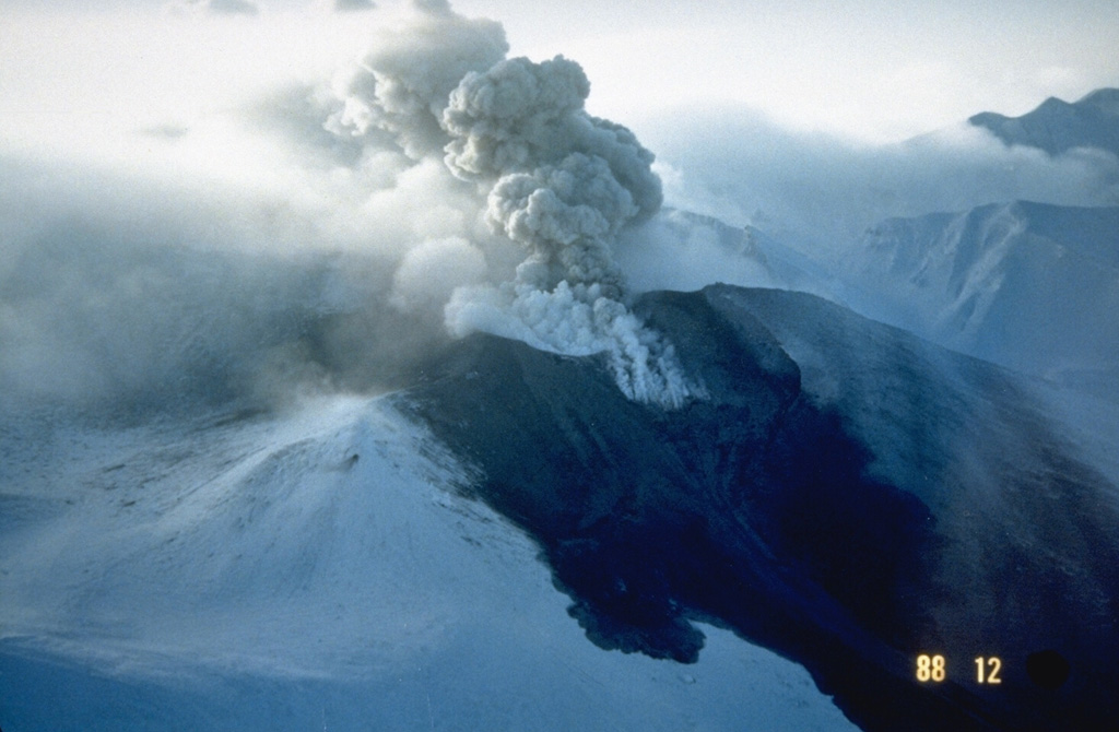
Volcano तोकाचीदाके
होक्काइदो के सबसे सक्रिय ज्वालामुखियों में से एक। मई 1926 में एक छोटे विस्फोट से शिखर का एक हिस्सा ढह गया और बर्फ़ की परत पिघल गई; कीचड़ का प्रवाह लगभग 25 मिनट में 25 किमी दूर कामिफ़ुरानो और बिएई के कृषि कस्बों तक पहुँचा और 144 लोगों की जान ले ली। यह 1962 और 1988–89 में फिर फटा और इस पर चौबीसों घंटे नज़र रखी जाती है।
Last Eruption
Erupted since 2000
Summit Elevation
स्तरित ज्वालामुखी · एंडेसाइट / बेसाल्टिक एंडेसाइट
Seismic State
0 events (1.0x rate)
Interactive Volcano & Seismicity Map
Seismicity within 50 km radius, active VAAC ash plumes, and tectonic plate boundaries.
Recent seismicity within 50 km
0 events in the last 12 h within 25 km of the crater.
No catalogued earthquakes within 50 km in the last 90 days.
Geological & Tectonic Profile
स्तरित ज्वालामुखीतोकाचीदाके is an active Stratovolcano(es) formed in an active Subduction zone / Continental crust (> 25 km). Dominant lithology: Andesite / Basaltic Andesite.
Volcanic Dossier
VN #285050Official catalogue parameters, coordinates, elevation and geotectonic classification.
Authoritative Monitoring Infrastructure
होक्काइडो द्वीप
Explore live seismic monitoring, historical danger benchmarks, fault slip models and recurrence intervals for होक्काइडो द्वीप.
क्षेत्रीय हब खोलेंअक्सर पूछे जाने वाले प्रश्न (FAQ)
सत्यापित वैज्ञानिक, परिचालन और आपातकालीन प्रोटोकॉल
Catalogue: Smithsonian Institution, Global Volcanism Program.Smithsonian GVP profile