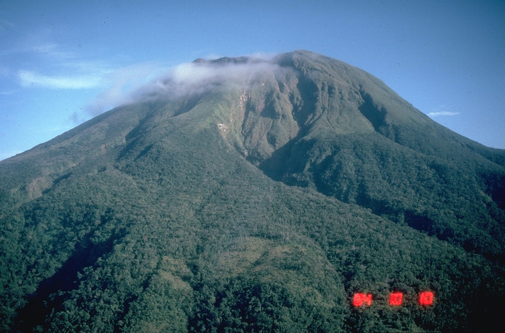
Volcano بولوسان
يرتفع أقصى براكين لوزون جنوباً فوق الغابات المطيرة وبحيرات الفوهات في مقاطعة سورسوغون. ويُعرف بولوسان بانفجاراته البخارية المفاجئة التي تأتي دون إنذار يُذكر؛ وقد غطّت أحدث موجات نشاطه في 2025 البلدات الزراعية المحيطة بالرماد، وبقيت منطقة الخطر الدائمة بنصف قطر 4 كم حول القمة مغلقة.
Last Eruption
Erupted since 2000
Summit Elevation
بركان طبقي · أنديزيت / أنديزيت بازلتي
Seismic State
0 events (1.0x rate)
Interactive Volcano & Seismicity Map
Seismicity within 50 km radius, active VAAC ash plumes, and tectonic plate boundaries.
Recent seismicity within 50 km
0 events in the last 12 h within 25 km of the crater.
| الوقت | القدر | مركز الزلزال / الموقع | المسافة |
|---|---|---|---|
| 3d مضت | M1.8 | 007 km S 52° E of City Of Legazpi (Albay) | 47 km |
| 16d مضت | M1.6 | 003 km S 74° W of City Of Sorsogon (Sorsogon) | 23 km |
| 17d مضت | M2.3 | 013 km S 78° E of Manito (Albay) | 37 km |
| 17d مضت | M2.1 | 012 km N 78° E of Manito (Albay) | 42 km |
| 18d مضت | M2.6 | 022 km S 83° E of Prieto Diaz (Sorsogon) | 46 km |
| 22d مضت | M2.4 | 004 km N 36° W of Batuan (Masbate) | 48 km |
| 22d مضت | M2.4 | 005 km N 82° E of San Jacinto (Masbate) | 37 km |
| 22d مضت | M1.8 | 004 km S 28° W of Monreal (Masbate) | 48 km |
| 27d مضت | M2.0 | 014 km S 67° E of Barcelona (Sorsogon) | 24 km |
| 28d مضت | M1.6 | 008 km N 01° E of Prieto Diaz (Sorsogon) | 41 km |
| 34d مضت | M2.0 | 008 km N 22° W of Monreal (Masbate) | 46 km |
| 38d مضت | M1.5 | 003 km N 31° E of City Of Sorsogon (Sorsogon) | 26 km |
| 39d مضت | M1.6 | 004 km S 83° E of Biri (Northern Samar) | 39 km |
| 39d مضت | M2.0 | 016 km N 40° E of Prieto Diaz (Sorsogon) | 49 km |
| 39d مضت | M2.6 | 003 km S 81° W of Rosario (Northern Samar) | 46 km |
| 41d مضت | M2.7 | 006 km N 39° W of Prieto Diaz (Sorsogon) | 37 km |
| 41d مضت | M1.7 | 001 km S 29° E of San Fernando (Masbate) | 45 km |
| 45d مضت | M1.6 | 012 km N 81° E of Prieto Diaz (Sorsogon) | 42 km |
| 46d مضت | M1.6 | 009 km N 40° W of Prieto Diaz (Sorsogon) | 38 km |
| 49d مضت | M2.5 | 009 km N 09° E of Prieto Diaz (Sorsogon) | 42 km |
| 49d مضت | M1.7 | 009 km S 15° W of Manito (Albay) | 38 km |
| 51d مضت | M2.1 | 004 km N 40° W of Lavezares (Northern Samar) | 36 km |
| 55d مضت | M2.7 | 005 km S 86° W of San Fernando (Masbate) | 49 km |
| 58d مضت | M3.4 | CATANDUANES, PHILIPPINES (PIVS) | 34 km |
Geological & Tectonic Profile
بركان طبقيبولوسان is an active Stratovolcano(es) formed in an active Subduction zone / Continental crust (> 25 km). Dominant lithology: Andesite / Basaltic Andesite.
Volcanic Dossier
VN #273010Official catalogue parameters, coordinates, elevation and geotectonic classification.
Authoritative Monitoring Infrastructure
لوزون & Manila وادي
Explore live seismic monitoring, historical danger benchmarks, fault slip models and recurrence intervals for لوزون & Manila وادي.
فتح المركز الإقليميالأسئلة الشائعة (FAQ)
البروتوكولات العلمية والتشغيلية والطوارئ المعتمدة
Catalogue: Smithsonian Institution, Global Volcanism Program.Smithsonian GVP profile