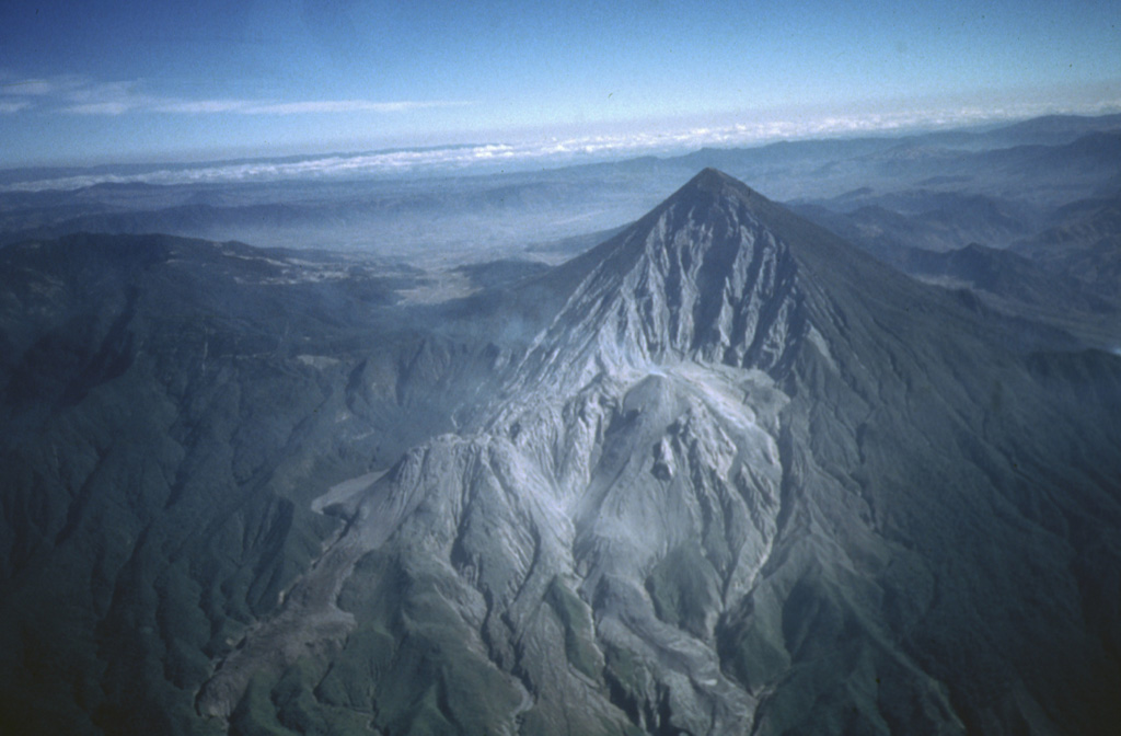
Volcano Santa María
Sein Ausbruch im Oktober 1902, einer der drei größten des 20. Jahrhunderts, riss die Flanke des Berges auf und tötete rund um Quetzaltenango mindestens 5.000 Menschen. Seit 1922 wachsen in dieser Narbe die Lavadome des Santiaguito, die noch heute viele Male am Tag kleine Ascheexplosionen ausstoßen.
Last Eruption
Erupted since 2000
Summit Elevation
Stratovulkan · Dazit
Seismic State
0 events (1.0x rate)
Interactive Volcano & Seismicity Map
Seismicity within 50 km radius, active VAAC ash plumes, and tectonic plate boundaries.
Recent seismicity within 50 km
0 events in the last 12 h within 25 km of the crater.
| Zeit | Magnitude | Epizentrum / Ort | Entfernung |
|---|---|---|---|
| 13d her | M4.0 | GUATEMALA (INET) | 29 km |
| 14d her | M4.0 | GUATEMALA (INET) | 41 km |
| 16d her | M4.6 | 5 km E of San José El Ídolo, Guatemala | 39 km |
| 30d her | M2.9 | GUATEMALA (INET) | 31 km |
| 43d her | M3.0 | GUATEMALA (INET) | 32 km |
| 69d her | M3.4 | GUATEMALA (INET) | 50 km |
| 71d her | M4.3 | 4 km SW of Almolonga, Guatemala | 4.6 km |
Geological & Tectonic Profile
StratovulkanSanta María is an active Stratovolcano formed in an active Subduction zone / Continental crust (> 25 km). Dominant lithology: Dacite.
Volcanic Dossier
VN #342030Official catalogue parameters, coordinates, elevation and geotectonic classification.
Authoritative Monitoring Infrastructure
Häufig gestellte Fragen (FAQ)
Geprüfte wissenschaftliche, operative und Notfallprotokolle
Catalogue: Smithsonian Institution, Global Volcanism Program.Smithsonian GVP profile