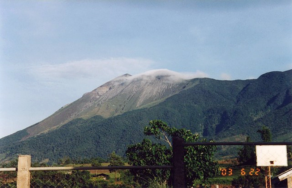
Vulkan Kanlaon
Der aktivste Vulkan der Zentralphilippinen, auf der Insel Negros. Explosive Ausbrüche seit Juni 2024 schickten pyroklastische Ströme und Asche über Bauernorte und zwangen Zehntausende Menschen in Evakuierungszentren. Eine plötzliche Dampfexplosion tötete 1996 drei Wanderer.
Letzter Ausbruch
Ausbruch seit 2000
Gipfel
Stratovulkan · Andesit / Basaltandesit
Aktivität
0 Ereignisse (1.0-fache Rate)
Interaktive Karte von Vulkan & Seismizität
Seismizität im Umkreis von 50 km, aktive VAAC-Aschewolken und tektonische Plattengrenzen.
Aktuelle Seismizität im Umkreis von 50 km
0 Ereignisse in den letzten 12 h im Umkreis von 25 km um den Krater.
| Zeit | Magnitude | Epizentrum / Ort | Entfernung |
|---|---|---|---|
| 22h her | M1.9 | 005 km S 71° W of City Of Silay (Negros Occidental) | 47 km |
| 3d her | M2.6 | 016 km N 77° E of City Of La Carlota (Negros Occidental) | 8.6 km |
| 6d her | M2.2 | 011 km S 61° W of City Of Silay (Negros Occidental) | 46 km |
| 8d her | M1.6 | 006 km N 87° W of Murcia (Negros Occidental) | 28 km |
| 10d her | M3.0 | 003 km S 23° E of Murcia (Negros Occidental) | 21 km |
| 11d her | M3.0 | 007 km S 80° E of City Of Canlaon (Negros Oriental) | 17 km |
| 12d her | M2.4 | 005 km West of Barili (Cebu) | 48 km |
| 20d her | M1.6 | 006 km N 48° W of Dumanjug (Cebu) | 45 km |
| 24d her | M1.6 | 011 km S 02° W of Murcia (Negros Occidental) | 15 km |
| 24d her | M2.0 | 016 km N 58° W of City Of Canlaon (Negros Oriental) | 6.5 km |
| 29d her | M2.0 | 014 km S 20° E of Murcia (Negros Occidental) | 10 km |
| 29d her | M2.6 | 015 km N 57° W of City Of Canlaon (Negros Oriental) | 6.5 km |
| 30d her | M3.0 | NEGROS- CEBU REG, PHILIPPINES (PIVS) | 6.5 km |
| 30d her | M2.9 | 011 km N 89° E of City Of La Carlota (Negros Occidental) | 12 km |
| 30d her | M3.0 | 015 km N 58° W of City Of Canlaon (Negros Oriental) | 6.5 km |
| 30d her | M2.8 | 015 km N 56° W of City Of Canlaon (Negros Oriental) | 6.5 km |
| 30d her | M3.0 | NEGROS- CEBU REG, PHILIPPINES (PIVS) | 13 km |
| 30d her | M3.2 | 015 km N 56° W of City Of Canlaon (Negros Oriental) | 6.5 km |
| 30d her | M3.0 | 010 km N 87° E of City Of La Carlota (Negros Occidental) | 13 km |
| 30d her | M1.5 | 010 km S 12° E of Murcia (Negros Occidental) | 14 km |
| 30d her | M1.7 | 015 km N 57° W of City Of Canlaon (Negros Oriental) | 6.5 km |
| 30d her | M1.6 | 013 km N 50° W of City Of Canlaon (Negros Oriental) | 5.6 km |
| 30d her | M2.1 | 016 km N 25° E of La Castellana (Negros Occidental) | 7.1 km |
| 30d her | M2.0 | 014 km N 20° E of La Castellana (Negros Occidental) | 8.4 km |
| 30d her | M2.6 | 015 km N 57° W of City Of Canlaon (Negros Oriental) | 6.5 km |
| 32d her | M1.8 | 013 km S 45° W of City Of Canlaon (Negros Oriental) | 12 km |
| 32d her | M1.6 | 013 km S 09° W of City Of Canlaon (Negros Oriental) | 17 km |
| 34d her | M1.9 | 009 km N 19° W of City Of Canlaon (Negros Oriental) | 8.6 km |
| 34d her | M2.4 | 008 km N 13 W of City Of Canlaon (Negros Oriental) | 9.5 km |
| 34d her | M2.8 | 003 km S 64° W of La Libertad (Negros Oriental) | 45 km |
| 34d her | M1.8 | 005 km N 72° E of Moises Padilla (Negros Occidental) | 14 km |
| 34d her | M2.8 | 007 km S 72° E of Moises Padilla (Negros Occidental) | 18 km |
| 34d her | M1.7 | 011 km N 37° W of City Of Canlaon (Negros Oriental) | 6.5 km |
| 35d her | M2.4 | 009 km N 28° W of City Of Canlaon (Negros Oriental) | 7.8 km |
| 40d her | M2.1 | 010 km N 52° W of City Of Canlaon (Negros Oriental) | 3.6 km |
Geologisches & tektonisches Profil
StratovulkanKanlaon ist ein aktiver Vulkan vom Typ Stratovulkan in der tektonischen Umgebung Subduktionszone / kontinentale Kruste (> 25 km). Vorherrschendes Gestein: Andesit / Basaltandesit.
Vulkan-Dossier
VN #272020Offizielle Katalogparameter, Koordinaten, Höhe und geotektonische Einordnung.
Maßgebliche Überwachungsinfrastruktur
Insel Mindanao & Graben
Entdecken Sie für Insel Mindanao & Graben die seismische Live-Überwachung, historische Gefahrenvergleiche, Versatzmodelle der Verwerfungen und Wiederkehrintervalle.
Regionales Zentrum öffnenHäufig gestellte Fragen (FAQ)
Geprüfte wissenschaftliche, operative und Notfallprotokolle
Katalog: Smithsonian Institution, Global Volcanism Program.Profil beim Smithsonian GVP